Bishop Peak is the most beautiful mountain in San Luis Obispo, with its rocky outcroppings at the top. You can hike all the way up, which takes about two hours roundtrip (4 miles, 1053 feet). The beginning of the hike is open space and then lovely shady forest, and you can usually see rockclimbers enjoying the fairly easy climb along the side of the path. Next the hike becomes more exposed and sunny (come early in the day) and has quite a few rocks to climb over (hard on the knees). This continues for quite a while until you reach the top. There are great views of the empty spaces around the town of SLO, and the breezes are wonderfully cool. Along the way you encounter some cute rock formations straight out of the Flintstones! There are usually a lot of people on this trail, especially on the weekend.
Afterward, relax with a cup of tea at Scout Coffee in downtown SLO.
Another great mountain hike is Eagle Rock Nature Trail!
Other hikes in the area are the Lemon Grove Loop Trail which leads to many other hikes, and the Terrace Hill Open Space, a super short hike. If you're looking for a shady flat three mile walk, you'll love the Bob Jones Bike Path in Avila Beach.
Bishop Peak, as seen from the trailhead.
I love the sandstone boulders.
The beginning of the hike.
The forest area is the nicest part.
Views from the top!
Awesome sheer rock faces.
A hiker walks through the shade.
Rock-climbers prepare to climb.
The hiking path goes through a boulder-strewn landscape.
View of empty spaces in SLO.
Flintstones-style boulders.
This is the mountain you climb up! As seen from Toro Street.
Hiking in patches of fog.
Rock formations shrouded in fog.
I love the rocks.
View of the town below.
Rocky edge and the town below.
Boulders.
Fog in the boulders.
Near the top.
Beautiful rocky crags.
Boulders and fog.
Fog at the top.
Looking down on clouds.
Resting on a rock.
Boulders strewn down the side.
The beautiful shapes at the top.
Hiking sign on Patricia Drive.
Views as you walk up the trail.
Views as you come down, of the mountains behind Cal Poly.
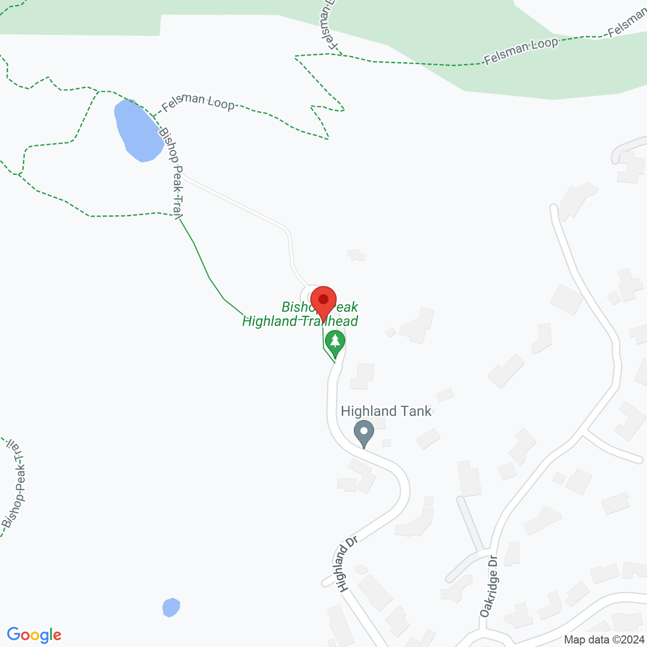
The trailhead is located at 1 Highland Drive. You can park along the road but the spots fill up early on the weekend.
Last Updated: Sun, 02 Feb 2025 03:02:10 GMT
Text and Image copyright: © 2006-2025 LotsaFunMaps.com.
Copying prohibited. Contact the editor |
Facebook |
Pinterest |
Instagram
Blog |
The Official Mug |
Privacy Settings |
About Us