It's lovely at the top of St. Louis Heights, where Cook pines were planted and now grow in abundance. Enjoy their knobbly trunks and the way they reach way up to the sky. You can bring a picnic and eat it at the tables with views over gorgeous Manoa Valley. Then work off your food with a hike. The trail is 2.4 miles, very steep at the beginning, and too slippery to use after rains. Sometimes in very late summer there are cherry guavas growing along the trail. You can see great views over Honolulu all the way to the ocean.
St. Louis Heights is near University of Hawaii at Manoa.
The beautiful Cook pines.
Moss-lined pathway and tall trees.
Pines overlooking Manoa Valley.
Closeup of a Cook pine trunk.
Baby Cook pines!!
Beautiful Manoa Valley...one of the nicest places in the world!
Trees reaching up to the sky.
Tropical plant near the beginning of the trail.
Young tree.
Tree roots on the hike.
View of the ocean and Diamond Head from a side path on the hike.
Hiker on the trail.
Picnic pavilion in the forest.
View of Waikiki.
Cook pine and Manoa mountains.
Rooster!
Purple bougainvillea on the road down.
Looking up at St. Louis Heights from Manoa Valley District Park.
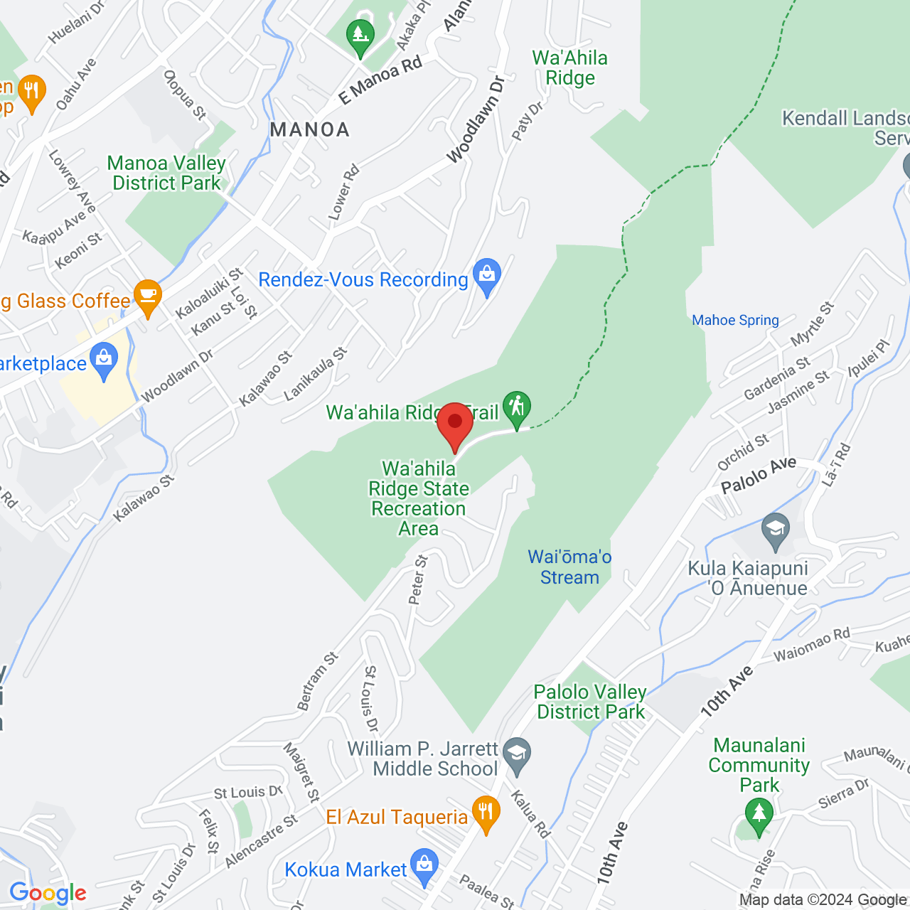
The forest at the top of St. Louis Heights is called Wa'ahila Ridge State Recreation Area. It is located at Ruth Pl, Honolulu HI 96816.
From Waialae Ave in Kaimuki (near University of Hawaii Manoa), drive up St. Louis Dr. Near the top, turn right on Peter St. Turn left on Ruth Pl where you will see the brown sign for the park. There is free parking in the parking lot.
Shannon Tierney
Sun, 13 Feb 2022
I liked the pics and the map I also liked the info but maybe add a little more info like about rules and stuff to look for or look out for.
Last Updated: Sat, 29 Jul 2017 20:00:19 GMT
Text and Image copyright: © 2006-2025 LotsaFunMaps.com.
Copying prohibited. Contact the editor |
Facebook |
Pinterest |
Instagram
Blog |
The Official Mug |
Privacy Settings |
About Us