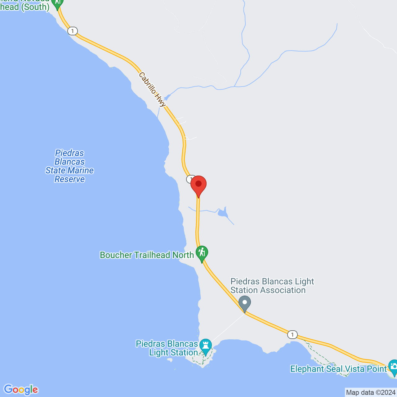
Big Sur Coast Drive from San Simeon

NOTE: There are mudslides all the time. Check that the road is open before you leave! Before you go: Book the 9:45am Piedras Blancas Light Station tour ahead of time online. Download offline google maps before you go, because you won't have cell phone reception- input the names of the places you want to stop into google maps before you leave, since you will only have GPS not cell service. Bring a $10 bill in cash (no change given) for the parking lots (you only pay once and then save your receipt) and a $10 bill in cash for Limekiln Beach (which is private and bills separately).
This is the drive from San Simeon going north. If you are heading south from Monterey, check out a different entry.
Driving the Big Sur coastline along Highway 1 is an iconic California adventure. The drive itself is not as difficult as rumor has it, and is definitely worth the beautiful day it will give you! The actual driving is two hours, but with stops along the way it takes about five to six hours. This stretch of highway is between Elephant Seal Viewing Point in San Simeon in the south, and Garrapata State Park in Monterey in the north. Come in July-March to avoid foggy summer days that will make your photos look drab.
Your first stop on the drive is Elephant Seal Vista Point. This is definitely worth it. Depending on the time of year, there will be big aggressive male elephant seals (November), harems of mommy seals, or baby seals (January). You can watch them from the wooden boardwalk, very close up! It is fascinating. Walk north for several kilometers to see more elephant seals in little coves or between rocks. Ten minutes drive south of the vista point, the Friends of the Elephant Seal Visitor Center (open daily 10-4) has good information, cute toys, and a clean restroom.
Next, stop at the old Piedras Blancas Hotel parking lot. To the left of the hotel is a path to the edge of the cliffs where you can hear elephant seals make the funniest noises, like a bottle going underwater making big gurgling sounds!! It is so fun. You can see them playing in the water.
At 9:45am on Tues, Thurs, and Sat, you can join a tour of Piedras Blancas Light Station starting at old Piedtras Blancas Hotel parking lot (book ahead of time online, by 9am, or ask to join last minute and hope that you can). The open land around the light station is beautiful (you can only come here on a tour), especially on a sunny day, with endless fields of yellow flowers in summer meeting the ocean, and white rock formations offshore. The flowers remind me of San Diego. There is just a short talk and then you can wonder the trail along the cliffs and enter the buildings at your own pace. In winter, you can see elephant seals playing in the cove below, making the funniest loud gurgling sounds! The lighthouse itself is musty and the top is missing, but this is still a wonderful place to visit. Note that there are no restrooms at the lighthouse, only portapotties.
Ragged Point Inn is a great place to stop to enjoy absolutely incredible views. Don't miss seeing the steep cliffs and vibrant blue-green water below! There is a lovely garden with a cypress tree forest over the sea. There are flowers, a round sculpture, plus adirondack chairs looking down on the stunning view. You can walk over a hundred steep steps down to the water, but most people don't. They have a restaurant which is nice for a bowl of soup, coffee shop with good matcha lattes, and gift shop. In summer, they have live music, Sat and Sun 1-4pm.
Salmon Creek Trailhead is next, with a small parking pullout area. It doesn't mention the waterfall 0.5 miles away on the first sign, but start the trail. Once you come to a choice of two ways, follow the arrow to the waterfall. Beware poison oak everywhere! You come to a clearing with enormous boulders. Then down a little way, you come to a pool of clear water with little fish in it. It is beautiful, with huge trees! You can't easily get closer to see the upper pool where people are swimming. That takes much climbing over slippery-even-when-dry rocks and tightrope walking a tree trunk. Stop before that or you will hurt your knees!
Buckeye Trailhead is a second later, and further on is Soda Springs Trailhead. We haven't tried these very steep trails.
Nathaniel Owings Redwood Grove is next, a 0.5 mile dirt trail to a redwood gulch with a bubbling stream that sounds so beautiful, and square-shaped rocks, ferns, and flowers around it. Looking up at the redwood trees, you feel in awe like you are at a national park! Continue along the trail and you get to a waterfall making the loveliest sounds. You can climb up above it. Nathanial Owings worked to conserve redwood trees. There is no sign at the trailhead, but it is the southernmost parking lot and path, once google maps takes you there. A short way in, you see a Los Padres Forest sign that says Redwood Grove. The path is not cleared very well, so you must keep brushing your pants to make sure you don't pick up any ticks.
Gorda Springs Resort is a rustic area with a cafe, gas station with electric charge, and market where you can buy snacks and small milk cartons to keep you going. You can eat at the outdoor chairs with lovely views of the water. There is a clean restroom.
We haven't visited the next two areas:
Treebones Resort has food at Wild Coast Restaurant, a sushi restaurant open for dinner, with views of the sea. Los Burros Road is a beautiful dirt road to drive up the cliffs with views of the sea below.
Willow Creek Picnic Area and Beach is a pretty spot to stop a while, where a creek meets the ocean.
Sand Dollar Beach, with its clean strip of sand and then strip of pebbles of lovely patterns, has happy surfers and youthful couples, giant rock formations including one like a sharp tooth, and cliffs of dark green granite. You can walk a short trail through cypress trees and then down 100 steps to the beach. The parking lot has restrooms, and you pay $10 cash by the honor system. If you already paid for another parking lot on this drive, you can just show that receipt on your dashboard. This beach is pretty at sunset and all the time! You can skip pebbles on the surface of the water!
Pacific Valley Bluff Trailhead (we haven't visited it), accessed through a low wire fence across from the Pacific Valley Fire Station, provides a walk through the springtime fields of poppies, past cows, to two overlooks where you can see rocks jutting out of the ocean, periodically swooshed with sea spray. Watch out for muddy spots along the path, and don't let any grasses with ticks touch your skin. You can extend your walk along the clifftop and down to Sand Dollar Beach.
Mill Creek Picnic Area (we haven't visited it) is next, on a rugged beach where a creek meets the ocean. Mill Creek Trail leads through redwood forest with views of the ocean, but many say it is a difficult trail and overgrown.
Limekiln State Park is amazing. The beach there is one of my favorite stops, leaving magical memories. To stop there costs $10 cash (they don't give change so bring a $10 bill), paid to the ranger at the gate (this is a private ranger station so your receipt from parking at other stations does not count). The hike to the falls (often closed) has lovely moss-covered rocks and forest. The beach is even more wonderful. From the parking lot, we walked through forest, on a footbridge over a crystal clear stream, then under a giant concrete overpass to the beach. Strewn on the sand, beside the river, are sparkling white rocks. We dipped our toes in the river, sat on the smooth rocks, peered up at the huge bridge, and listened to the ocean. It was a wonderful stop! There are clean restrooms at this stop. The second time I visited, I took off my shoes and socks to cross the river and stood at the shore, listening to the pebbles roll back and forth in the waves. What a wonderful sound! Then I stood on a huge gray rock as the waves whooshed all around me. It was exhilarating! The river or creek is likely springfed because it is far more clear than usual.
Next you drive past Paul's Slide, a landslide area, where the cliff is barren.
After, on your right, see the sign for the New Camaldoli Hermitage. It is so worth it to drive their short road up to the bench with the pullout next to it! The views here are incredible, especially on sunny day. Wow, that color of the water is like the caribbean! And there are many shades of blue-green. Breathtaking! Sometimes, if it is foggy, you can sit here, above the clouds! The drop is just vertical and you are so high up. Continue up the hill. There is a pullout by the Fence Loop Trail, which takes you up a steep wide dirt path with views of the valley. The rows of pines and shape of the pointed mountains are gorgeous. Next, you reach the bookstore and chapel, open 1:30-4:30. Morro Bay residents love the holy granola, so buy some if you can! The chapel is currently closed for repair (2025). There are clean restrooms. People come to the hermitage for silent retreats.
Next, you pass Lucia Lodge, but the restaurant is no longer open for business. Past it is where the Regent's Landslide took place, closing the road for years! But it is not repaired!
You pass some fantastic cliff faces covered abundantly in fluffy pampas grass. We stopped at a stunning overlook next, Big Creek Cove Vista Point (you can tell it by its row of square rocks outlining the dirt parking lot), with views of a bridge similar to Bixby Bridge, called Big Creek Bridge. Bright plants framed each photo and I was in heaven! Travelers from Europe, mostly Germany, sat on the sandstone rocks at the overlook, eating picnics.
Julia Pfeiffer Burns State Park, specifically McWay Cove (photo above), is one you have seen on many postcards, with a cove of bright turquoise water, a promontary with cypress trees, and a thin waterfall falling onto the beach. The path is in disrepair so you can't continue far along it, and you can't go down to the beach. If you choose to stop here, know that it is a tourist trap. It is packed with visitors clamoring to stand at the far end of the path where it has been barricaded for repair, trying to get a glimpse of the waterfall. It costs $10 cash by the honor system (I only had a $20 bill and felt a bit gypped when I left it in the envelope in the metal box at the front gate). There is a traffic jam at the gate while everyone fills out their envelopes. You park in a parking lot full of people frantically looking for a spot. Do not walk on the path at the end of the parking lot. This just leads to Highway 1, a waste of time. Instead, walk back to the front gate and take the stairs which lead to the pedestrian tunnel which takes you to the viewing point for McWay Cove. You can also just park along the highway, but it will be on the mountain side of the road, if you want to avoid the parking lot. There are many much nicer, secluded trails, beaches, and overlooks to stop at, that will leave you feeling happier.
There are more amazing overlooks and trails to stop at as you continue on your drive. Partington Cove Trail, Boronda Trailhead, Coast Big Sur (a coffee shop in a water tank, open Friday to Monday), and Grimes Point Overlook (which looks down on a beach), to name a few.
Nepenthe is a great place to stop for a meal (they open at 11:30am), 30 minutes from the end of your drive. The restaurant at the top is often full, and expensive, but you can eat at the lower patio which has stunning views of the ocean and many tables with sun umbrellas. It's a blissful spot! You order at the counter, which also saves you an hour of waiting for wait service. They have smoothies, salads, and sandwiches.
You now reach open meadows over the sea. Big Sur Bakery is open most days for breakfast, lunch, and dinner, but closed on Tuesdays all day, and closed at dinnertime on Sunday and Monday.
The geography is quite varied on this drive. You now drive through redwood forest, past some cabins-in-the-woods style hotels with cafes, and campgrounds, such as Big Sur River Inn (with a cafe with a patio over the river, open 8am-9pm), Big Sur Campground and Cabins, Glen Oaks Big Sur (expensive hotel with cafe), Big Sur Roadhouse (a restaurant open 8am-2:30pm) and more. You can buy gas in this part of town. This is the tiny town of Big Sur, which even has an elementary school, Captain Cooper School, with only 49 students.
Andrew Molera is a good spot to stop for clean restrooms, 20 minutes from the end of your drive. The ranger at the gate won't charge you the entry fee if you let him know you are just stopping for the restrooms for less than fifteen minutes. But you have probably already paid for one of the earlier parking lots, and you can use your ticket for this one as well.
You will drive past Point Sur Naval Facility, where there is a lighthouse on a big volcanic rock. This secret (the public thought it was for oceanographic research) site was built during the cold war to detect Russian submarines. Long-range acoustic listening was tested at the lighthouse. This station detected the location of a wrecked Soviet submarine, quite an intelligence coup. You can tour the light station on Wednesdays and weekends.
Another lovely place to pull off is after Little Sur River Viewpoint, where you can stand by a fence and look back at Little Sur River Beach and its creamy blue-green lagoon. This is about 16 minutes from the end of your drive.
One of the last stops you'll probably do is Castle Rock Viewpoint, ten minutes from the end of your drive, to see the famous marvel of engineering, Bixby Bridge. It will hopefully be afternoon by now so the sun will be in the right spot for photos.
You are now in Carmel/Monterey! Carmel River State Beach is 25 minutes away. And Cannery Row, ten minutes further, is a good place to have dinner in Monterey, at Bubba Gump Shrimp Company.
The amazing road!
Backlit green-blue wave at Limekiln State Beach!
White water swooshing between rocks at Limekiln State Park.
The clear river under the highway overpass at Limekiln State Park.
Views along the highway near New Camaldoli Hermitage.
The clear river as it winds toward the shore at Limekiln State Park!
Stopping for a snack at Ragged Point.
The greenery looks lovely behind the rocks.
Serene views from the highway near New Camaldoli Hermitage.
The picnic tables where you can have breakfast or lunch at Ragged Point.
The clear creek at Salmon Creek Trail.
Fog at the top of the hills, as seen from the highway.
You can see the road hugging the cliffs from Ragged Point.
Views of the coastline from Ragged Point.
Redwoods at Nathaniel Owings Redwood Grove.
The leafy redwoods at Nathaniel Owings Redwood Grove.
The smaller waterfall at Salmon Creek Falls.
Walking down to the ocean view at Ragged Point.
A cute place, Ragged Point.
Mill Creek Picnic Area, as seen from above.
I love the many colors of the rocks at the beach in Limekiln State Park.
Huge white rocks on the beach in Limekiln State Park.
Driving the Rain Rocks Rock Shed, a structure on top of Pitkins Curve Bridge.
Views of the mountains and headlands at Mill Creek Picnic Area.
Pointy rock on the coast, as seen from Mill Creek Picnic Area.
A pilot car leads us through an area where a rock is about to fall.
After Ragged Point, you must wait for a pilot car to lead you through a rockfall area.
The wonderful blue-green waves, and yellow flowers along the coastline, at the Piedras Blancas Light Station.
Following a pilot car!
The blue line on the horizon and the open road!
Winding road and blue line on the horizon!
The winding road is beautiful.
Bird rock offshore, and blue line near the horizon.
Pointy rock at Mill Creek Beach.
Pebbles making lovely sounds with the waves, at Mill Creek Beach.
Strand of trees above the road.
Stunning scenery near Mill Creek.
NOTE: Starting January 15, 2026, you can drive all the way to Monterey because the Regents Landslide area has been repaired.
The drive on Highway 1 along the Big Sur Coastline is 78 miles long. It is winding in some parts but not bad. The actual driving is two hours, but with stops along the way it takes about five hours. This stretch of highway is between Elephant Seal Vista Point in San Simeon in the south, and Garrapata State Park in Monterey in the north. If you start from the north, the lookouts will be on your side of the road, but it's still nice from the south.
You only need to pay the $10 once, to park in any of the paid parking lots along the Big Sur Coastline. Just display your receipt. Some of the parking lots have a ranger at the gate, and some are paid by honor system (such as Julia Pfeiffer State Park)- you rip off the receipt from the envelope. The only parking lot that is private and therefore must be paid extra, is Limekiln State Park.
Last Updated: Tue, 24 Feb 2026 00:32:39 GMT
Text and Image copyright: © 2006-2025 LotsaFunMaps.com.
Copying prohibited. Contact the editor |
Facebook |
Pinterest |
Instagram
Blog |
The Official Mug |
Privacy Settings |
About Us